Skip to content

We're hiring! Click here to view available positions

  • Blog
  • Careers
  • Client Login
Menu
  • Blog
  • Careers
  • Client Login
logo
logoRear v2
logoForward v2
  • Home
  • About
    • About Stahly
    • Our Clients
    • Our Team
      • Leadership
      • Helena Office
      • Bozeman Office
      • Billings Office
  • Services
    • Bridges
    • GIS
    • Grant Administration
    • Planning & Technical Review
    • Land Surveying
    • Site Development/Subdivisions
    • Structural Engineering
    • Transportation
    • Water & Wastewater
  • Projects
Menu
  • Home
  • About
    • About Stahly
    • Our Clients
    • Our Team
      • Leadership
      • Helena Office
      • Bozeman Office
      • Billings Office
  • Services
    • Bridges
    • GIS
    • Grant Administration
    • Planning & Technical Review
    • Land Surveying
    • Site Development/Subdivisions
    • Structural Engineering
    • Transportation
    • Water & Wastewater
  • Projects
Get In Touch
Get In Touch
Menu
  • Home
  • About Stahly
  • Services
  • Projects
  • Blog
  • Careers
  • Client Login
  • Contact
Menu
  • Home
  • About
    • About Stahly
    • Our Clients
    • Our Team
      • Leadership
      • Helena Office
      • Bozeman Office
      • Billings Office
  • Services
    • Bridges
    • GIS
    • Grant Administration
    • Planning & Technical Review
    • Land Surveying
    • Site Development/Subdivisions
    • Structural Engineering
    • Transportation
    • Water & Wastewater
  • Projects
General

Discover the Potential of POINT CLOUD TECHNOLOGY

April 15, 2022

See how our Survey Team at Stahly Engineering is using innovative technology to bring a new perspective to our clients’ projects.

Stahly Engineering uses modern survey technology to produce point cloud datasets for modeling, planning, and design purposes. Point clouds are a means of collating a large number of single spatial measurements into a dataset that can then represent a whole. The colorization of single points within a point cloud then present a 3D model.

DATA COLLECTION:

  1. Stahly uses terrestrial scanning, which utilizes LIDAR (light detection and ranging) technology and techniques to collect tens of thousands of individual points per second.
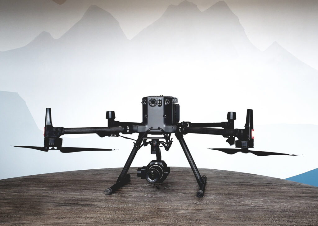
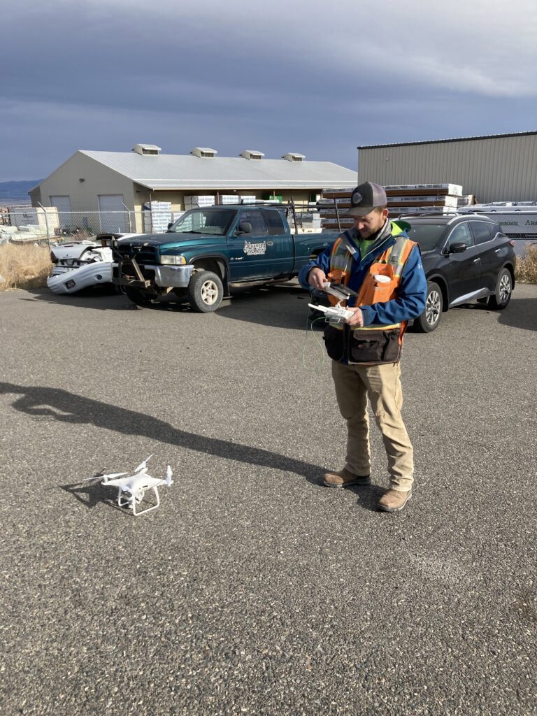
  2. Stahly also utilizes Unmanned Aerial Vehicle (UAV) technology and photogrammetry survey techniques. Photogrammetry uses individual, overlapping, high resolution photographs to generate detailed 3D point clouds. This technology allows for large scale data collection in a short period of time.

PROJECT EXAMPLE:

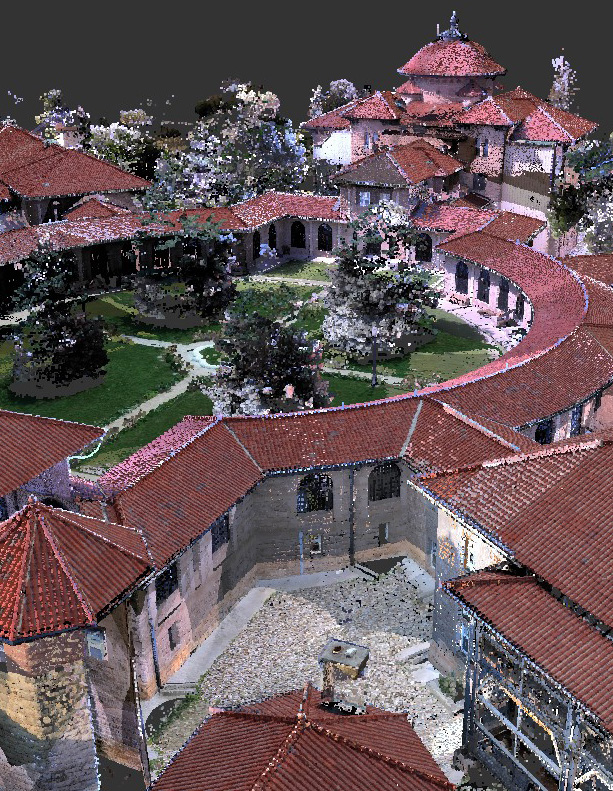
VA BLACK HILLS HEALTH CARE SYSTEM CAMPUS: This survey included a UAV flight to capture photogrammetric data of the entire survey area including roads, sidewalks, site features, and the buildings of interest. The result of this survey was a high-density point cloud model on a published horizontal and vertical datum as pictured below.

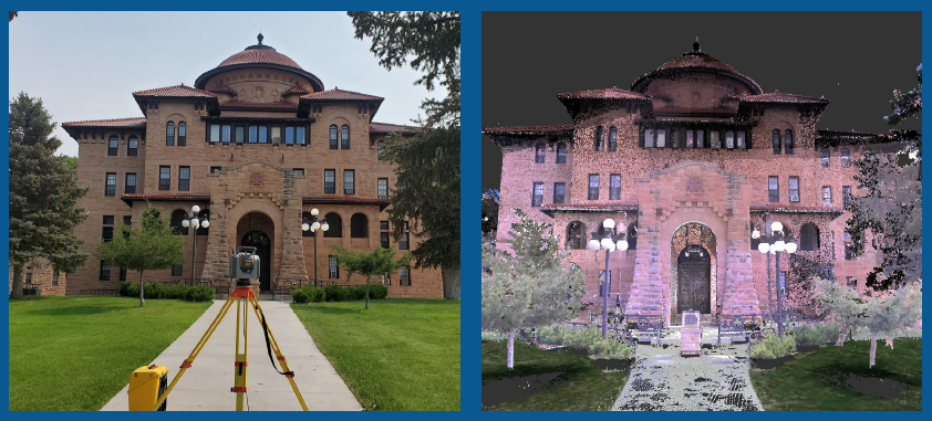
In addition, terrestrial laser scanners were utilized to scan the buildings of interest with even higher detail and precision than was provided via the UAV. These scans were all registered with one another to create a conglomerate dataset that matched the spatial reference of the UAV survey. The data captured by the terrestrial scanners which was not captured via the UAV provided the necessary “fill-in” data with higher precision than the overall UAV survey. By filtering out less precise points from the UAV data of the buildings, one final dataset was created which modeled both the buildings and the site with high precision- all on a published horizontal and vertical datum.

Share:
Facebook
Twitter
LinkedIn
Email
Back to Blog
PrevPrev. PostSustainable Growth in Gallatin County
Next PostIn the newsNext
Tell Us What Your Goals Are

Ready to start your project?

Stahly Engineering is available to help you plan and execute your next project involving engineering, survey, or grant services.

Get In Touch

Navigation

  • Home
  • About
  • Our Team
  • Contact
  • Services
  • Projects
  • Clients
  • Blog
  • Client Login
  • Careers
Menu
  • Home
  • About
  • Our Team
  • Contact
  • Services
  • Projects
  • Clients
  • Blog
  • Client Login
  • Careers
Helena Office
3530 Centennial Drive
Helena, MT 59601

(406) 442-8594

Office manager: Robie Culver
Email Us
Bozeman Office
851 Bridger Drive, Suite 1
Bozeman, MT 59715

(406) 522-8594

Office manager: Theron Thompson, P.E.
Email Us
Billings Office
2223 Montana Ave, Suite 201
Billings, MT 59101

(406) 601-4055

Office manager: Dax Simek, P.E.
Email Us
Previous
Next

Helena Office

3530 Centennial Drive
Helena, MT 59601

(406) 442-8594

Regional Manager:
Clint Smith, CET, CST

Bozeman Office

851 Bridger Drive, Suite 1
Bozeman, MT 59715

(406) 522-8594

Regional Manager:
Zach Lowe, P.E.

Billings Office

2223 Montana Ave, Suite 201
Billings, MT 59101

(406) 601-4055

Regional Manager:
Dax Simek, P.E.

Privacy Policy
©2021 Stahly Engineering & Associates, All Rights Reserved
Built by Bridger Digital 🏗

We're hiring! Click to see available positions

View