We're hiring! Click to see available positions
We're hiring! Click here to view available positions
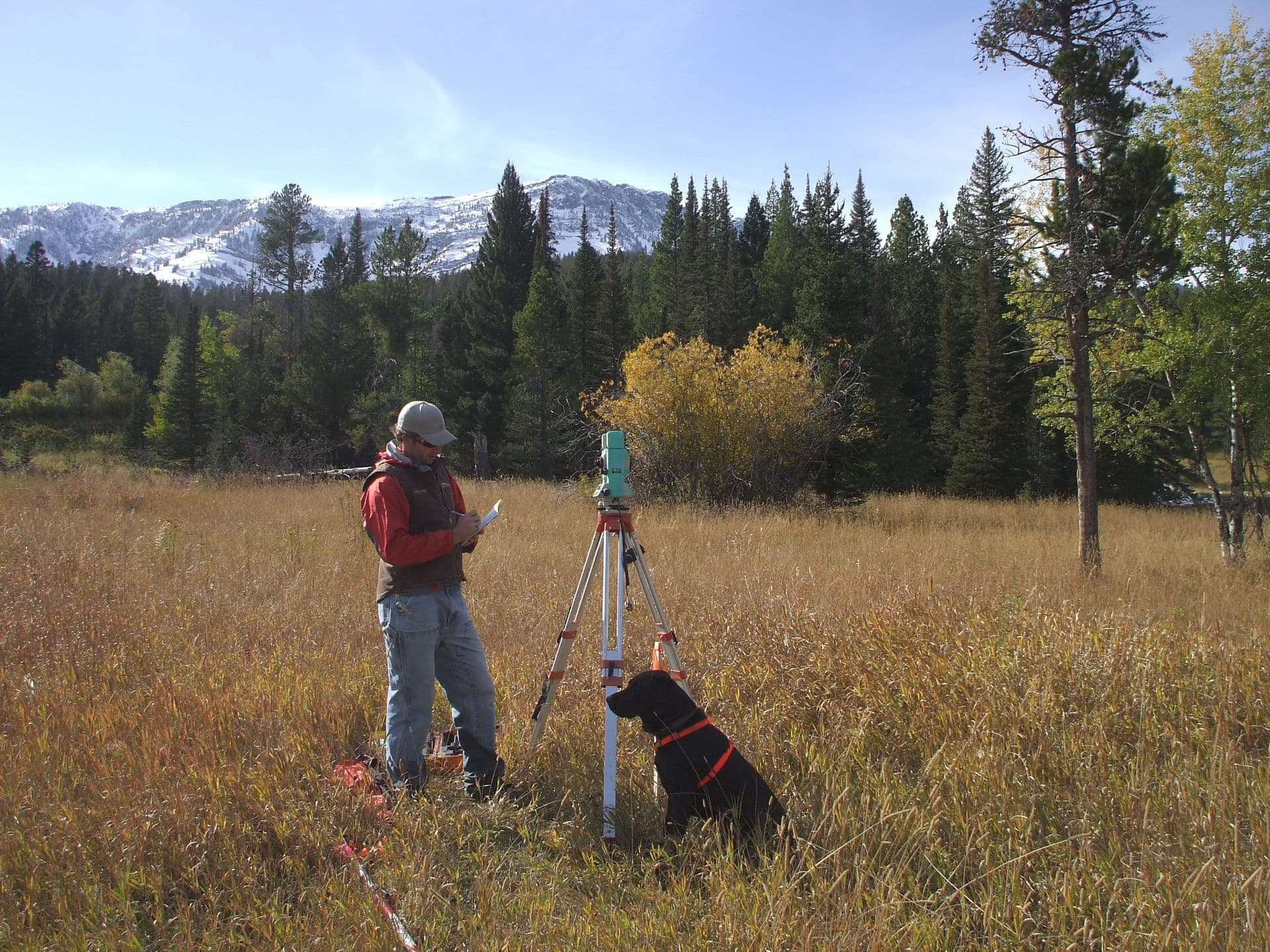
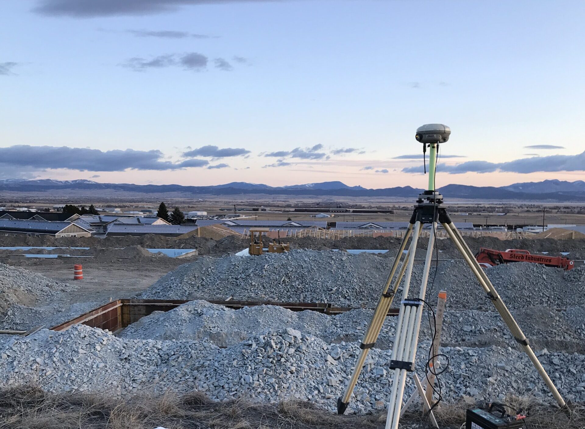
Professional Land Surveying is a cornerstone of Stahly Engineering’s services. We have been providing survey and construction staking services since our business began in 1970. The ability to provide any type of survey for each project that we undertake compliments our design process. Stahly Engineering is known for providing practical, buildable designs; these designs rely upon thorough and accurate data provided by our Land Survey Department.

A large portion of our land survey projects include property boundary or public land survey system elements. With rivers, lakes, Tribal lands, homestead entries, mineral patents, and vast land expanses still described within the U.S. Public Lands Survey System in the state of Montana; finding, mapping and describing boundaries is a major part of what we do.
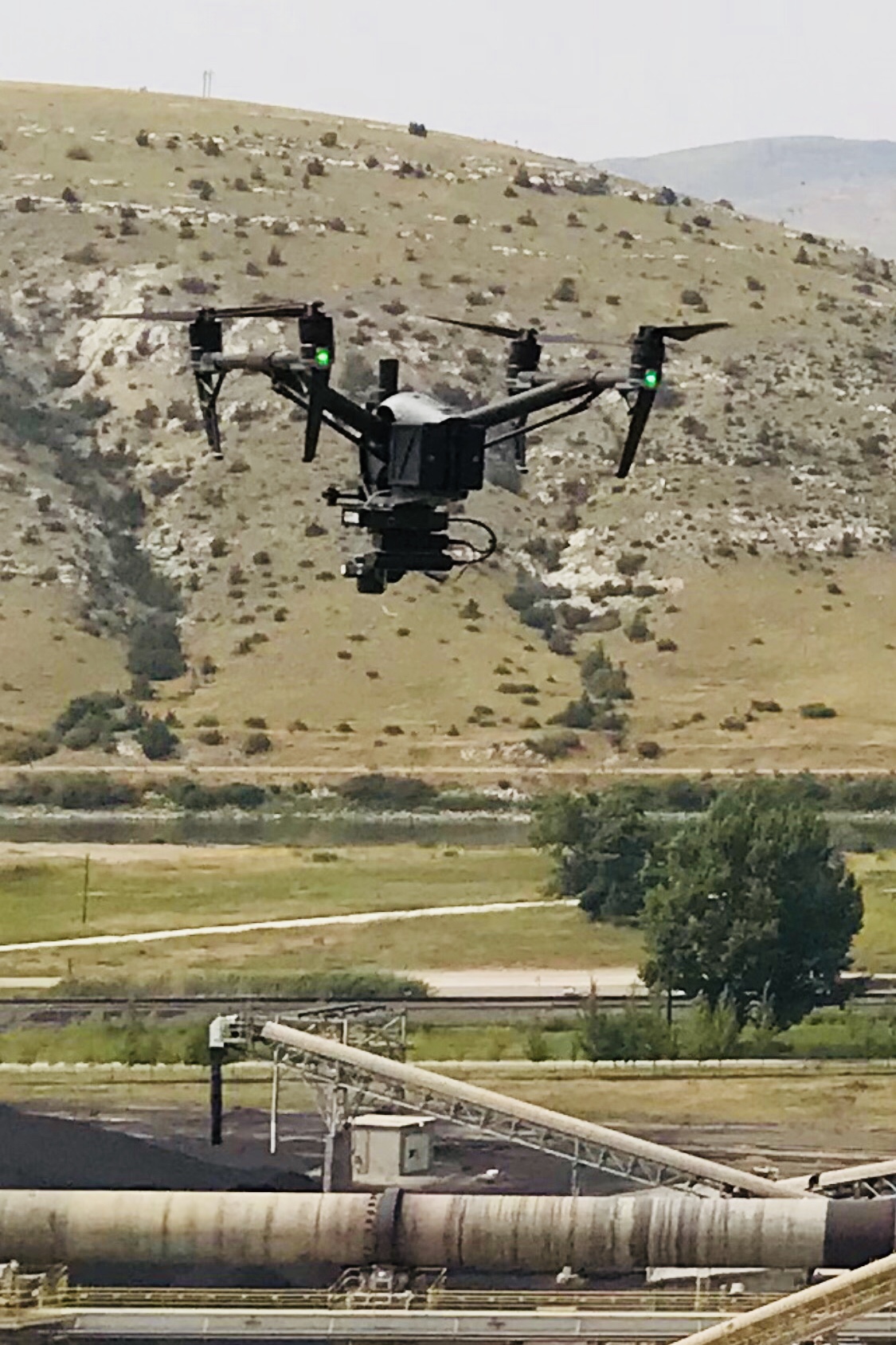
In order to help our firm grow, the survey team continues to keep up to date on the latest technological tools and advances. The most recent innovation in which Stahly has invested is our Unmanned Aerial System (UAS) with Klau Post-Processed Kinematic (PPK) technology. We utilize our highly sophisticated UAS in order to provide accurate survey products to our clients in an efficient and cost-effective manner. The centerpiece of this system is a PPK GPS receiver and pre-calibrated camera onboard the UAV. Unlike other photogrammetric methods commonly used throughout the industry, this system eliminates from our workflow the methodical setup of numerous ground control points, saving hours of on-the-ground field time and making it more cost-effective than conventional survey methods.
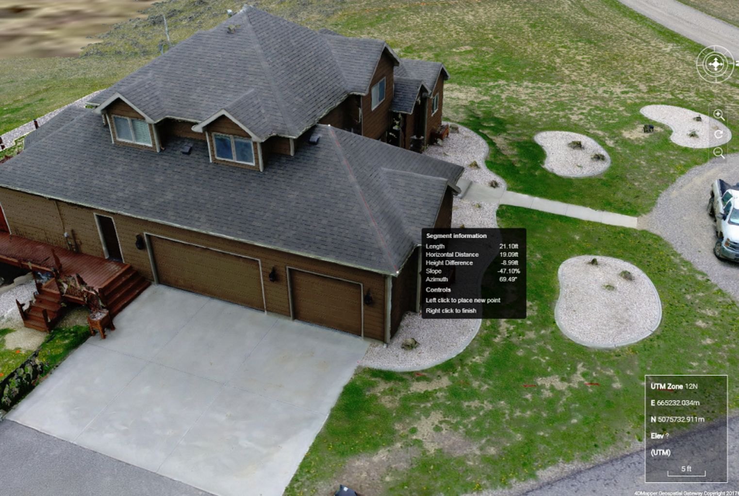
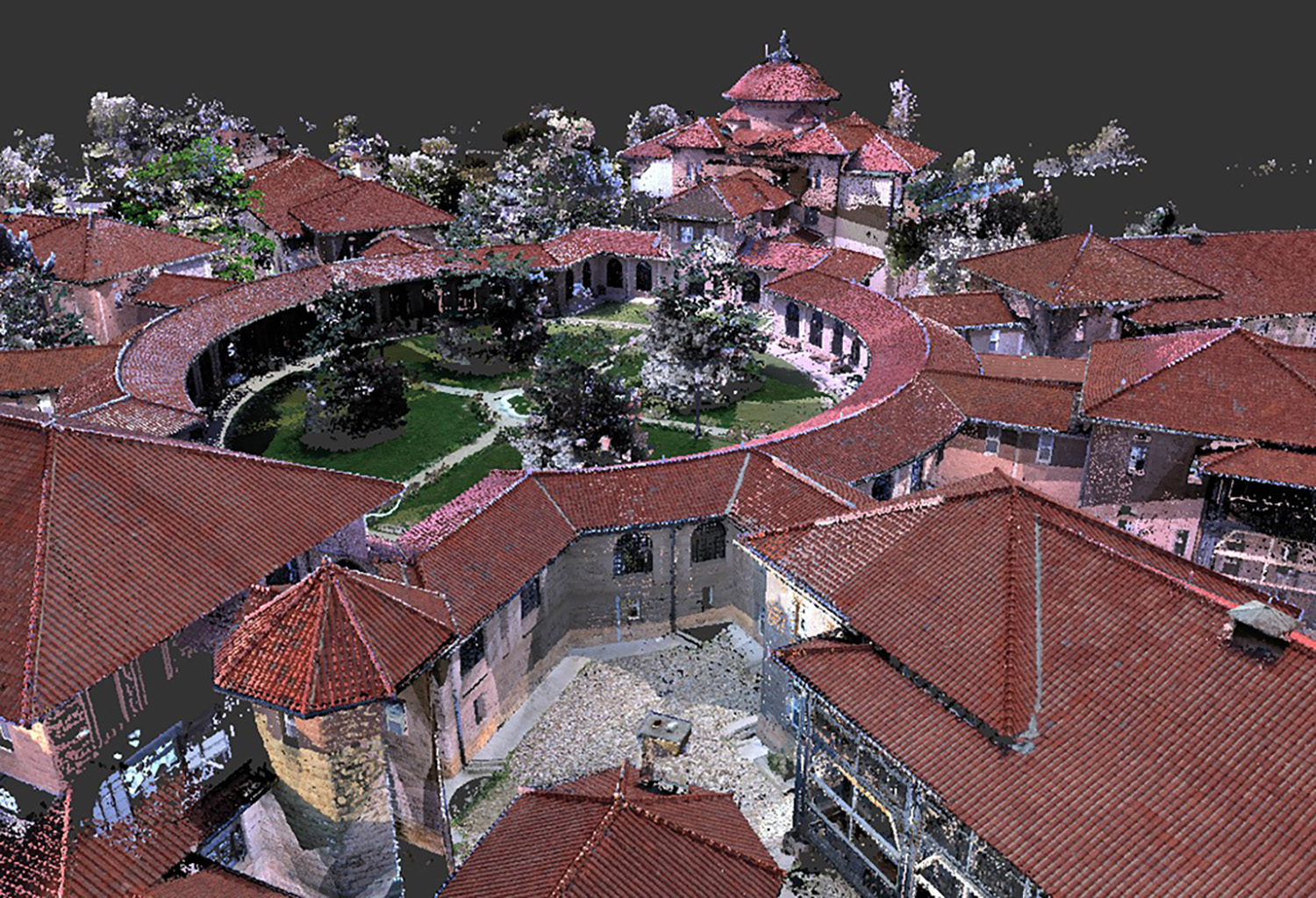
Stahly engineering uses modern survey technology to produce point cloud datasets for modeling, planning and design purposes. Point clouds are a means of collating a large number of single spatial measurements into a dataset that can then represent a whole. The colorization of single points within a point cloud then present a 3D model.
The technology:
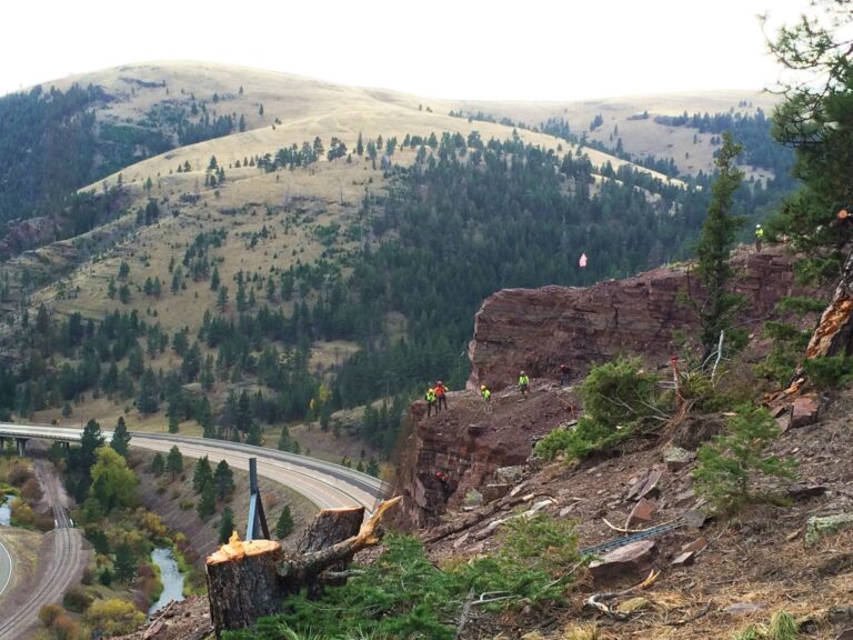
Stahly Engineering provided survey services for the Rockfall Mitigation project along the Wolf Creek Canyon.
Stahly Engineering is available to help you plan and execute your next project involving engineering, survey, or grant services.
Helena, MT Office
3530 Centennial Drive
Helena, MT 59601
Billings, MT Office
2223 Montana Ave, Suite 201
Billings, MT 59101
Bozeman, MT Office
851 Bridger Drive, Suite 1
Bozeman, MT 59715
Great Falls, MT Office
219 2nd Ave S, Suite 302
Great Falls, MT 59405
Cody, WY Office
1001 12th Street
Cody, WY 82414
We're hiring! Click to see available positions